Professional Land Surveyors
Hamilton • Burlington • Oakville • GTA
Survey Inquiry905-643-6131
Get a Quote
Hamilton • Burlington • Oakville • GTA
Hamilton • Burlington • Oakville • GTA
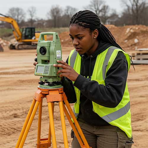
Land surveying, the art and science of determining the terrestrial or three-dimensional positions of points and the distances and angles between them, is fundamental to countless projects, from infrastructure development to property boundary delineation. Among the various techniques employed, utilizing topography stands out as a crucial method for understanding and representing the Earth's surface.
Topographic surveys provide essential data for designing roads, bridges, dams, and other infrastructure projects. Understanding the terrain allows engineers to calculate cut and fill volumes, determine drainage patterns, and optimize layouts.
Today's construction projects rely on topographic data for accurate grading, earthwork calculations, and ensuring proper drainage.
Real Estate Developers use topographic surveys to assess the suitability of land for residential, commercial, or industrial development.
Topographic Maps help in the planning of site layouts, designing drainage systems, and ensuring compliance with zoning regulations.
Topographic Surveys are crucial for environmental impact assessments, watershed management, and erosion control.
They assist in mapping out floodplains, identifying areas prone to landslides, and monitoring changes in landforms.
While boundary surveys primarily focus on property lines, topographic information can be valuable for understanding the context of the property and identifying potential issues related to drainage or access.
Topographic surveys are used to map mineral deposits, calculate ore volumes, and plan mining operations.
They help to manage the environmental impact of mining activities effectively.
Data collected during a topographic survey is used to create:
Maps that represent elevation changes using contour lines, which connect points of equal elevation.
Computerized representations of terrain surfaces, known as DEMs, used for deep analysis and visualization.
Realistic, interactive representations of the terrain, used extensively for visualization and structural planning.
The field of topographic surveying continues to evolve every day, with advancements in sensor technology, data processing, and visualization. The integration of artificial intelligence and machine learning is further enhancing the accuracy and efficiency of topographic surveys. As technology progresses, land surveying will continue to play a crucial role in shaping our building industry and managing our natural resources.